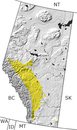
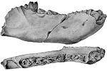
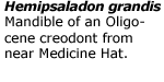
The Tertiary in Alberta, Canada

Tertiary in Alberta map

undifferentiated rock units help

Choose a time period:

Quaternary
Tertiary
Cretaceous
Jurassic
Triassic
Permian
Carboniferous
Devonian
Silurian
Ordovician
Cambrian
Precambrian

Tertiary Fossils
Fossil photos from Tertiary in Alberta

Previous (6 slides) Next
Search the fossil gallery

Paleontology and geology

After the Western Interior Seaway drained away, lakes and swamps filled the lowlands, and rivers flowed from the Rocky Mountains to the east and northeast. In the Early Tertiary, the climate was warm and humid. The land was covered with forests of sycamore, birch, and walnut, as well as katsura and dawn redwood, plants that were known to grow only in southeast Asia (until distribution by humans). Over time, the climate became cooler, and the forests were replaced by savannas and grasslands. Much of this plant material is preserved in Alberta’s coal fields, but fossils can also be found in sandstones and shales exposed in the south. These deposits have also yielded tracks and fossils of early mammals, including those of a venomous rodent-like mammal, Bisonalveus browni.

Links to more on the Tertiary in Alberta

Education and Exhibits

Education and Exhibits

Virtual Exhibits (showing 1 of 1 listings)

The Joffre Bridge Fossil Exhibition: The Joffre Bridge Roadcut locality reveals a diverse collection of Paleocene terrestrial and freshwater fauna and flora. This site describes the locality, its fossils, its history and how paleontologists have reconstructed its ancient environment.

top Top of List


Northwest Territories Province Map
Saskatchewan Province Map
Montana State Map
Idaho State Map
Washington State Map
British Columbia Province Map

site tour | about the site | site map | site credits | page credits | help | FAQs | contact
© | editorial policy | awards | teachers' guide | site generator | About RSS

paleontology news:   recent site additions: