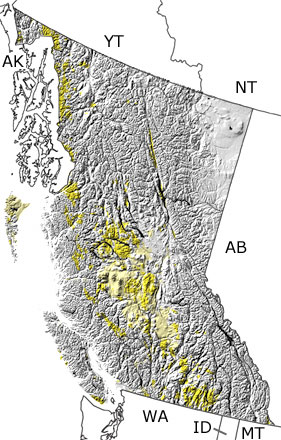
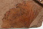
The Tertiary in British Columbia, Canada

Tertiary in British Columbia map

undifferentiated rock units help

Choose a time period:

Quaternary
Tertiary
Cretaceous
Jurassic
Triassic
Permian
Carboniferous
Devonian
Silurian
Ordovician
Cambrian
Precambrian

Tertiary Fossils
Fossil photos from Tertiary in British Columbia

Previous (5 slides) Next
Search the fossil gallery

Paleontology and geology

The Tertiary was a time of substantial tectonic activity in British Columbia. Subduction continued to pull oceanic crust under the continent in some areas, while the continental and oceanic plates were sliding past each other along large faults (e.g., Queen Charlotte Fault). Both of these processes brought magma up to the surface under British Columbia, and chains of volcanoes developed near the coast. The province also passed over a hotspot, which left a line of volcanoes from east to west across the middle, and more magma reached the surface in the east when all this movement pulled the crust apart. Large amounts of melted rock were pushed up below older rocks, uplifting the province and forming the granite rocks of the Coast Ranges. All this activity created more faults throughout the province, which developed into valleys between the mountains. These valleys were filled with sediments eroding from the mountains and substantial amounts of ash and lava ejected from the volcanoes. Deposits that formed in these valleys and on Vancouver Island preserve fossils of fish, insects, crustaceans, and many different plants. The conifer needles, fern fronds, mosses, and leaves, seeds, and fruit form flowering plants reveal a greater number of more modern forms.

Links to more on the Tertiary in British Columbia

Research and Collections

Research and Collections

Ongoing Research Projects (showing 1 of 1 listings)

McAbee Fossil Beds: The McAbee Fossil Beds are found in the Tranquil Shale near Cache Creek, British Columbia. These 50-million-year-old (Eocene) shales are sediments of a shallow lake that existed at a time when the Northern Hemisphere had a warm temperate climate. The fossil record shows that this was a time when palm trees grew as far north as Alaska. Some five dozen plant species have been described from the Tranquil shale, including more than 40 broadleaf and some 17 conifer species. Sassafras, katsura and ginkgo plant fossils have been found, as well as a diversity of insects, fish fossils, and even some feathers.

top Top of List


Yukon Territory Province Map
Northwest Territories Province Map
Alberta Province Map
Montana State Map
Idaho State Map
Washington State Map
Alaska State Map

site tour | about the site | site map | site credits | page credits | help | FAQs | contact
© | editorial policy | awards | teachers' guide | site generator | About RSS

paleontology news:   recent site additions: