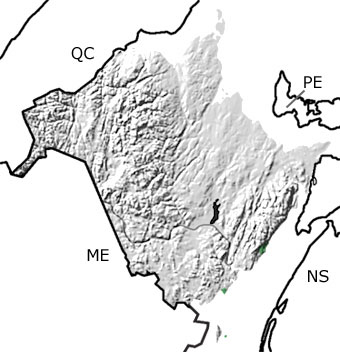
Paleontology and geologyAlmost as soon as the supercontinent Pangea came together, it began to split apart. Rift basins developed down the middle of the supercontinent, signaling the very beginning of the Atlantic Ocean. New Brunswick was above sea level during the Triassic, and erosion was the dominant force shaping the landscape. Most of the rocks from this time have been eroded away, except for a few small areas in southern New Brunswick along the coast. These Middle to Late Triassic reddish-colored sandstones and siltstones are also exposed across the bay in Nova Scotia. They were eroded off the surrounding highlands and deposited in rivers, floodplains, and mudflats in a rift basin that would become the Bay of Fundy. These rocks contain abundant pollen, invertebrate trace fossils, and reptile tracks. At the very end of this period, the crust thinned so much that fissures opened up, spewing lava and ash into the basin. These basalt and tuff deposits can be seen on Grand Manan Island in the south. Because this activity continued into the Jurassic, these rocks show up when you click the “SHOW undifferentiated rock units” button.
|


