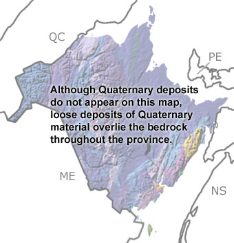
Paleontology and geologyGlaciers came and went many times in the Quaternary, shaping the present landscape of this province. All of New Brunswick, with the exception of areas in the Miramichi Highlands in the north, was glaciated at some point in the Quaternary. The ice formed U-shaped valleys in the highlands, gouging the land and picking up sediments as it moved. When the ice melted, it left a blanket of sediment, called till, over the province. In some areas, the melting ice shaped the deposits into drumlins, eskers, and moraines. Other glacial features, like striations and grooves in exposed bedrock and roches moutonees, show the direction that the ice moved. During the interglacial periods, forests and tundra covered the province. Mastodons once roamed the woodlands and swamps, and fossils of one have been found in lake deposits in southern New Brunswick, along with turtles. At these times, sea level was much higher than today. Old shorelines can be seen as wave-cut terraces in cliffs along the coastline. Some of the marine sandstones and shales contain fossils of echinoderms, bivalves, snails, and barnacles. More recent walrus fossils have also been found along the coastline and by scallop dragging in the Bay of Fundy.
|


