

The Tertiary in Southeast region, Mexico |
|||||||||||||||||||||||||||||||||||||||||||||||||||||||||||
|
|||||||||||||||||||||||||||||||||||||||||||||||||||||||||||
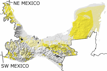
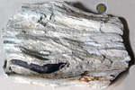
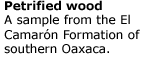
Paleontology and geologyThe Southeastern Region was pushed up and the seas drained away in the Tertiary. Subduction continued in the southwest, which formed masses of granite below the surface and caused volcanic eruptions. In between the eruptions, the land was covered in forests of temperate and tropical plants, chaparral, and grasslands, depending on the altitude and distance from the coast. These habitats, as well as lakes and rivers, hosted turtles, camels, horses, rhinoceroses, gomphotheres, weasels, rodents, and other animals from both North and South America. Pieces of fossilized tree sap (amber) from some of the trees preserve smaller creatures like spiders, scorpions, various insects, and even lizards. The shallow seas along the coasts were home to ghost shrimps, crabs, ophiuroids, corals, other invertebrates. In the Yucatan Peninsula, fresh water started to dissolve the limestone, and over time, caves, cenotes, and underground rivers developed throughout the area. During the Tertiary, a small land mass slid past the southern margin of this region to form Central America. Geologists continue to study how close this land mass came to Mexico, but its movement created faults and altered rocks in the southern part of this region. |
|||||||||||||||||||||||||||||||||||||||||||||||||||||||||||
|
|
|||||||||||||||||||||||||||||||||||||||||||||||||||||||||||

|
site tour |
about the site |
site map |
site credits |
page credits |
help |
FAQs |
contact |
||