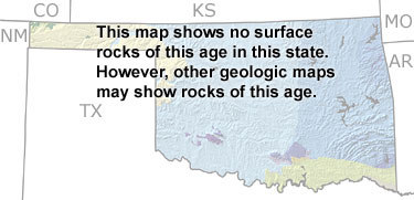
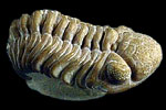
Paleontology and geologyAlthough this map does not show any Devonian surface rocks, other geologic maps indicate Devonian or undifferentiated Silurian-Devonian rocks in several areas near the eastern edge of Oklahoma and small regions in the south-central and southwestern parts of the state. The presence of brachiopod, trilobite, bryozoan, and crinoid fossils in the Arbuckle Mountains indicates that a shallow sea was present in this area during the Early Devonian. The sea withdrew and the state was exposed to erosion for much of the rest of the Period, but returned once again by the Late Devonian. Thick deposits of black shale (the Chattanooga Shale) are evidence that these later marine waters were oxygen-poor across most of the state. |