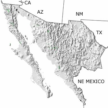
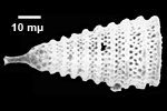
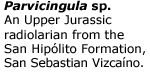
Paleontology and geologyThe Jurassic was a time of substantial tectonic activity in Northwestern Mexico, and geologists continue to study how rocks from this period formed. As Pangea rifted apart in the east, the crust adjusted by dropping some areas down into basins and pushing others up into highlands. In the west, volcanic islands and deep basins formed as subduction consumed oceanic crust along the continental margin. Volcanoes spewed ash and lava over the surface and under water, and magma pushed up under older rocks forming huge blocks of granite. The land was covered by many different plants, which are preserved today as layers of coal. Lakes were filled with ostracods, and rivers carried sediment out to coastal areas, where gypsum and salt deposits formed when sea water evaporated. In the shallow to deep seas, many different animals thrived, including bivalves, belemnites, corals, sponges, ammonites, echinoids, and radiolarians. Fossils of these animals can be found in some of the limestones, sandstones, shales, cherts, conglomerates, and ash deposits exposed in the west. Smaller exposures in other parts of this region can be found on more detailed maps. |