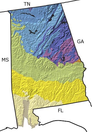
Paleontology and geologyThe Precambrian: Little is known about the Precambrian in Alabama. The few rocks of that age that do exist have been highly altered through metamorphism and contain no recognizable fossils.
The Paleozoic: Alabama lay in tropical to subtropical latitudes throughout most of the Paleozoic. By the Late Cambrian, the state was flooded by a shallow sea and a variety of marine organisms thrived in the warm waters. Toward the end of the Ordovician, there was an episode of mountain building (the Taconic Orogeny) followed by erosion and the deposition of sediments into the sea. Deposition continued through the Silurian, producing the iron-rich hematite layers that helped fuel Alabamas once thriving iron and steel industries. In the Devonian, shallow seas gave way to large areas of deeper, oxygen-poor water. Very few organisms could tolerate these conditions, so Devonian fossils are uncommon. Productive seas returned during the early Carboniferous (Mississippian). The Allegheny Orogeny was in full force by the late Carboniferous (Pennsylvanian). Subsequent erosion and deposition of sediments into the sea created a broad, tropical coastal plain where primitive trees and fern-like plants thrived. These forests are the source of the coal deposits across much of northern Alabama. The Permian was mainly a time of erosion, and no deposits of this period are known in the state.
The Mesozoic: Most Mesozoic rocks in Alabama are deeply buried beneath younger sediments, but drill cores provide information about the geologic history during this time. Rift valleys formed as the supercontinent of Pangea began to pull apart in the Triassic. By the Jurassic Period, these valleys intermittently filled with seawater, eventually forming the young Gulf of Mexico. As the Gulf widened and deepened, rich deposits of hydrocarbon—formed primarily from decaying single-celled organisms—accumulated in the sediments. Rocks from the Late Cretaceous represent both freshwater and nearshore environments, indicating that the shoreline lay far inland of its present position. Near-tropical forests covered the part of the state not inundated by the sea, while offshore lay a rich, warm ocean filled with marine life.
The Cenozoic: Subtropical seas covered the southern part of the state during much of the Tertiary. Sediment from the eroding Southern Appalachian Mountains produced a broad, coastal plain that supported near-tropical forests. During the Ice Age of the Quaternary (Pleistocene), Alabamas climate was dramatically altered even though glaciers never reached the state. Forests of spruce and other conifers covered northern Alabama, while mixed, drought-tolerant forests and grasslands dominated the south. Huge Ice Age animals such as mammoths, mastodons, and giant ground sloths roamed the landscape. |