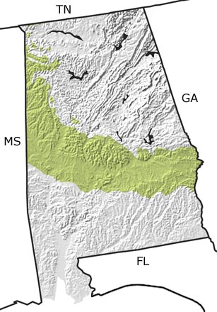
Paleontology and geologyRocks from the early part of the Cretaceous Period are all deeply buried in Alabama, but the last half of the Cretaceous is well preserved at the surface. These rocks contain both freshwater and nearshore sediments, indicating that the shoreline of the Gulf of Mexico lay far inland from its present position. This sandy shoreline ran from near Auburn in the east to just north of Montgomery and Tuscaloosa, then curved northward to just west of the Muscle Shoals area.
Fossil leaves from these sedimentary layers suggest that near-tropical forests covered the part of the state not inundated by the sea. Offshore lay a rich, warm ocean filled with marine life that left behind many fossils of clams, snails, ammonites, nautiloids, and even some complete skeletons of marine vertebrates such as turtles, fish, and mosasaurs. Fossils are so abundant in these layers that Alabama is recognized as one of the best locations in the world for collecting a variety of Cretaceous marine fossils. |