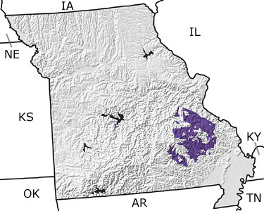
Paleontology and geologyDuring the Cambrian, most of Missouri was covered by a vast, warm, shallow sea that extended from Mexico to New York. Only a few land areas remained above sea level, represented by sandstones and shales exposed in the southeastern part of the state. As sea level continued to rise, limestones and dolostones formed from the deposition of limy sediments. These deposits are interbedded with sandy shales, which indicate that sea level fluctuated during this time. Trilobites, brachiopods, and stromatolites are the main fossils preserved in these rocks. Monoplacophorans (cap-shaped molluscs) and small snail-like fossils called Pelagialla have also been found in Missouri's Cambrian rocks. |

