The Cretaceous in North Carolina, US |
||||||||||||||||||||||||||||||||||||||||||||||||||||||||||||||
|
||||||||||||||||||||||||||||||||||||||||||||||||||||||||||||||
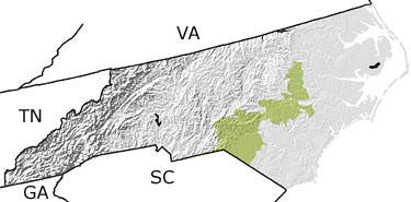
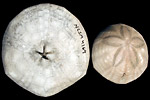
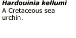
Paleontology and geologyDuring the Cretaceous, the Atlantic Ocean continued to widen, and from time to time the sea encroached on the land. Streams carried sediments from the eroding Appalachian Mountains and deposited them in a broad coastal plain. Oysters and other molluscs flourished in the warm waters where sands, muds, and |
||||||||||||||||||||||||||||||||||||||||||||||||||||||||||||||