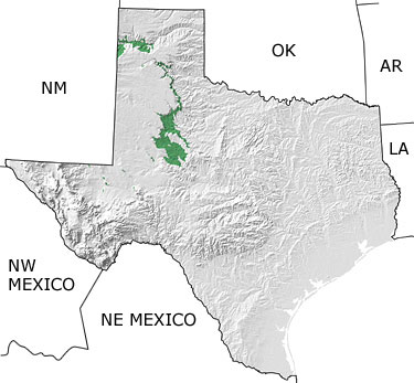
Paleontology and geologyThe Texas Triassic is well represented by a series of formations (the Dockum Group) found in the High Plains north of Amarillo, in the Caprock south of Lubbock, and to the south and east of Big Spring. The Dockum consists of sands and shales deposited in a large fluvial (river) system and has a well-documented vertebrate fossil record. At this time, the supercontinent of Pangea was in the early stages of its breakup, and the Gulf of Mexico was beginning to open. The occurence of Triassic rocks are shown in the north-central part of Texas on this map. |