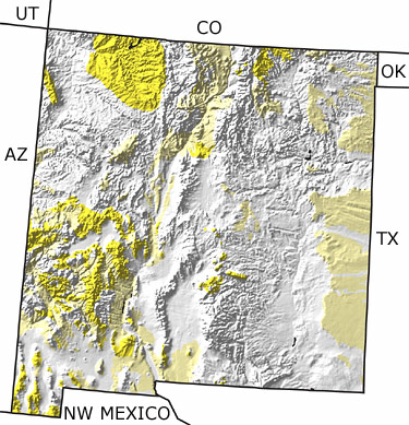
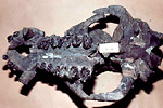
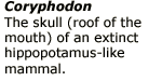
Paleontology and geologyDuring the Early Tertiary, a mountain-building event, referred to as the Laramide Orogeny, turned much of New Mexico into ranges and basins. River floodplains and lakes covered the lowlands. The middle of the Tertiary was a time of pervasive volcanism, and the eruptions left behind huge calderas. By the Late Tertiary, plate movements fractured the earths crust, pulling it open along the Rio Grande to form a chain of rift basins in which rivers, lakes, and dune fields deposited sediment. Fossils of magnolia, a four-tusked elephant called Gomphotherium, and the hippopotamus-like mammal Coryphodon are typical of the terrestrial flora and fauna. Fossils of a gar fish, Atractosteus are also common. This map indicates extensive exposures of Tertiary rocks throughout the state. |