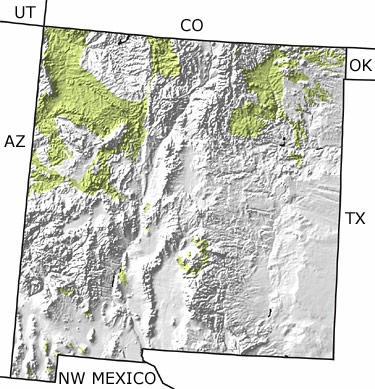
Paleontology and geologyDuring the Cretaceous, New Mexico was split by a seacoast, with sea to the east and land to the west. Huge rivers flowed from the west to a coastline hugged by dense jungles and coal-forming swamps. Dinosaurs roamed the area. The muddy sea floor to the east filled with oysters and other molluscs. Ammonites and other sea creatures swam in the warm shallow waters. This map indicates that most of the exposures of Cretaceous rocks occur in the northern sections of the state with only small patches in the central and southern areas. |