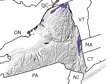
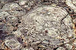
Paleontology and geologyWhen the Grenville mountain-building episodes ended in the late Precambrian, a long period of erosion followed. During the same time, the Iapetus Ocean opened and widened as the Precambrian supercontinent broke apart, creating small rift basins. These basins filled with sediments eroding off the Grenville Mountains. Early Cambrian rocks formed from these sediments are exposed in several places around the Adirondack Dome in New York. During the Late Cambrian, global sea level rose, flooding New York and most of the Northeast with a shallow sea. Sedimentary rocks were formed from sands, silt, and clay deposited in this sea. This map indicates exposures of Cambrian rocks in the northern and eastern parts of the state. |