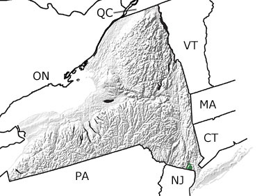
Paleontology and geologyMost New York rocks from the Early and Middle Mesozoic have not been officially subdivided into Triassic and Jurassic. During these periods, the supercontinent Pangea continued to break apart. This rifting activity along the margin of North America caused blocks of crust to drop, forming basins. Magma pushed up through fractures in the crust and poured out on the surface as basalt. In some cases the magma cooled and crystallized as igneous intrusions below the surface. New Yorks Palisades Sill is a crystallized igneous intrusion of this type. The rift basins filled with sediment and, periodically, with water to form shallow lakes. The reddish-brown sedimentary rocks of one of these Triassic-Jurassic rift basins are exposed in the southeastern corner of New York along the Hudson River. |