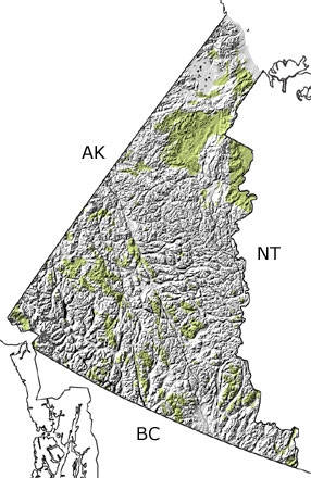
Paleontology and geologyMost of Yukon Territory was covered in mountains through the Cretaceous, while subduction continued to consume oceanic crust in the southwestern part of the territory. This activity forced magma up to the surface, which created the huge granite blocks that make up the Coast Range and formed many of the deposits of gold, silver, copper, tin, and other economically important minerals in the Yukon. At the edge of the continent, subduction added slices of oceanic crust and the remaining volcanic islands that form the westernmost part of the territory. The collisions that brought these pieces together folded, faulted, and metamorphosed some of these rocks, as well as older ones that were already part of the continent. Large coal beds and fossils of giant redwoods and ginkgoes suggest the land was covered with forests and swamps. Dinosaurs roamed these areas and left their tracks in muds and sands. Although dinosaur fossils are rare, a few bones of a hadrosaur have been found. Some rocks form this period may be included in the undifferentiated Mesozoic rocks on this map because the substantial alteration and movement they experienced makes them difficult to date. |


