home   Printer friendly version Add to site
Advanced search
Time & Space Fossil Gallery Famous Flora & Fauna
Careers Resources K-12 Collections PaleoPeople

The Cambrian in Ontario, Canada

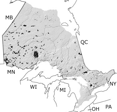
Cambrian in Ontario map

undifferentiated rock units help

Choose a time period:

Quaternary
Tertiary
Cretaceous
Jurassic
Triassic
Permian
Carboniferous
Devonian
Silurian
Ordovician
Cambrian
Precambrian

Cambrian Fossils

No slide show is available for the Cambrian in Ontario.

Search the fossil gallery

Paleontology and geology

As part of the Laurentian continent, most of Ontario was above sea level and exposed to erosion during the Cambrian. In the southeastern part of the province, sandstones and conglomerates record ancient rivers and deltas that flowed out to the sea in the east. Some sandstones from the Late Cambrian contain ripple marks and evidence of wind transport, indicating they were deposited in dune fields. These dunes were likely near the sea because some layers preserve tracks and traces of arthropods. The traces record the oldest evidence of life moving around on land. Toward the very end of the period, the sea began to move inland, covering parts of the southeast with shallow waters.

Links to more on the Cambrian in Ontario

Research and Collections

Research and Collections

Ongoing Research Projects (showing 1 of 1 listings)

Burgess Shale Research page at the Royal Ontario Museum: This page provides information on research being conducted at the Royal Ontario Museum on fossils from the Burgess Shale, with a list of recent publications. Links to press releases of important discoveries and podcasts are also provided.

top Top of List


Quebec Province Map
New York State Map
Pennsylvania State Map
Ohio State Map
Michigan State Map
Wisconsin State Map
Minnesota State Map
Manitoba Province Map