

The Carboniferous in Arkansas, US |
|||||||||||||||||||||||||||||||||||||||||||||||||||||||||||
|
|||||||||||||||||||||||||||||||||||||||||||||||||||||||||||
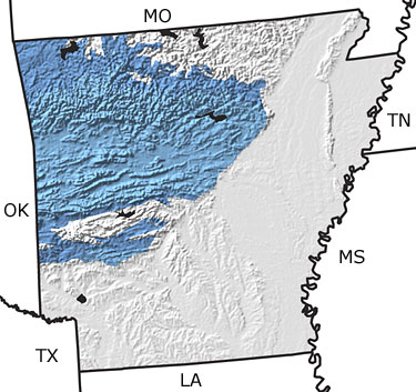
Paleontology and geologyDuring the Early Carboniferous, limy sediments accumulated in a shallow sea that covered what is now northern Arkansas. This sea was home to brachiopods, crinoids, and bryozoans. Deeper waters covered the central and southern portions of the state at this time. As rivers and streams eroded the continent, clastic sediments began to accumulate on top of the shallow water deposits, further reducing the water depth. Fossils of ammonites and of plants that washed in from the land, as well as trace fossils, can be found in these rocks. By the Late Carboniferous, the sea receded, exposing new land drained by numerous rivers. These rivers washed sand and mud into the deeper water that remained over what is now central and southern Arkansas. The sandstone and shale that formed from these sediments contain rare ammonites, plant fossils, and trace fossils. South America collided with Arkansas during the Late Carboniferous. This tectonic activity caused the folding and faulting of earlier-formed rocks into the Ouachita Mountains in central Arkansas. |
|||||||||||||||||||||||||||||||||||||||||||||||||||||||||||
|
|
|||||||||||||||||||||||||||||||||||||||||||||||||||||||||||


|
site tour |
about the site |
site map |
site credits |
page credits |
help |
FAQs |
contact |
||