The Permian in Texas, US
|
|
||||||||||||||||||||||||||||||||||||||||||||||||||||||||||||

Paleontology and geology
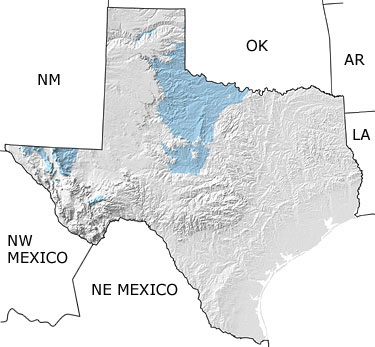
Permian rocks are well exposed in north-central Texas from San Angelo north to the Red River. As you travel north, you can trace the change from marine to more terrestrial conditions in these Permian outcrops. The classic red bed sequence in this area contains extensive salt and gypsum deposits and has a well-documented and rich vertebrate fossil record. In far western Texas, in the Guadalupe Mountains, you can see the remains of a Permian barrier reef, trending east-west along Highway 62/180 into New Mexico. The limestones and sandstones of this reef environment are rich in marine invertebrates, but contain only a few vertebrate fossils.
Links to more on the Permian in Texas
Ongoing Research Projects (showing 1 of 1 listings)
Vertebrate Paleontology Laboratory, UT: The University of Texas Vertebrate Paleontology Laboratory houses one of the 10 largest collections in North America, and it supports one of the Nation's largest graduate education programs in paleontology. It also supports public exhibits at the Texas Memorial Museum.