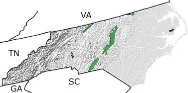
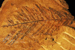
Paleontology and geologyDuring the Triassic, rift basins formed in North Carolina as the supercontinent Pangea began to break up and the Atlantic Ocean began to develop. The Deep River and Dan River Basins, which extend northeasterly across the state, formed during this period of faulting, and lake and river deposits of reddish conglomerates, sandstones, shales, and eventually coal formed within these basins. Conifers and cycads grew along the lake margins; clams, crustaceans, and fish flourished in the aquatic environments, and various reptiles and mammal relatives roamed the area. This map indicates the presence of Triassic rocks in the north and in the central part of the state. |